The Aegean is the sea that is surrounded between the coasts of mainland Greece, the coasts of Asia Minor and Crete. Morphologically speaking, the Aegean constitutes a relatively shallow sea, since it comes from the submergence of Aegeis land. Its seabed though is corrugated by several trenches, some parts of which have a quite long depth, while this complex coastline results in the creation of many small and big bays, capes and natural ports. The geographers and the geologists have divided the Aegean Sea in three parts following the morphology of the coasts, the position of the islands and the formation of the seabed. North, Central and South Aegean.
The borders of South Aegean is the northern imaginary line from Sounion and Kafireas up to Samos and the coasts of Asia Minor and the southern borders of the sea are from Laconia, Kythera and Crete up to cape Marmaris in Asia Minor.
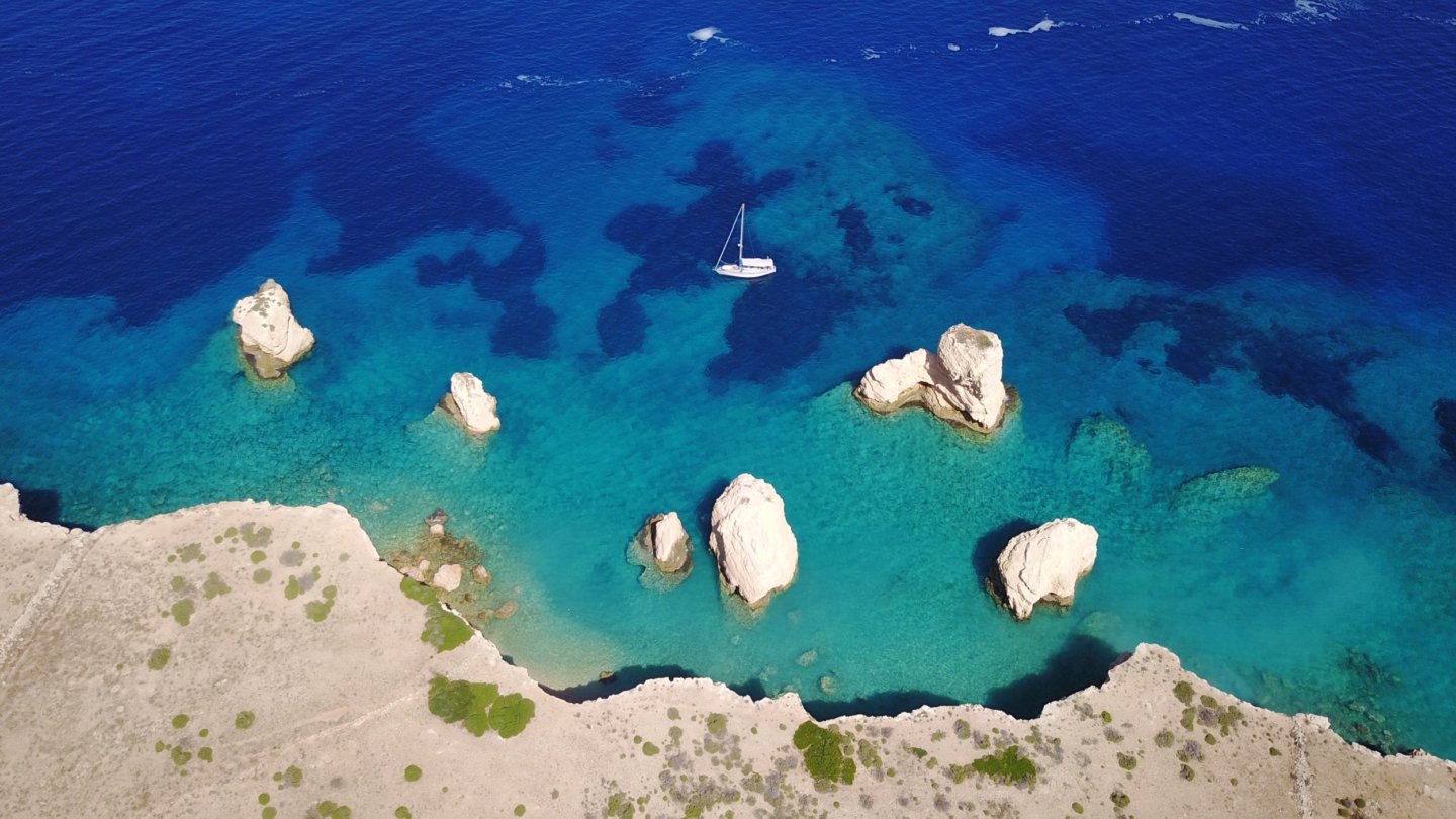
The South Aegean is considered the most important part of the Aegean Sea. Most of the islands are located in it. The two big complexes, meaning the Cyclades and the Dodecanese, the islands of Ikaria, Samos and Fournoi on the east and on the west the islands of the Saronic Gulf near Attica and the Argolic Gulf in Peloponnese. The South Aegean is divided in smaller seas, the Myrtoan Sea on the west, the Cretan Sea on the south and the Icarian Sea and the Karpathian Sea on the east. Each of these seas usually shows special local weather conditions and this is very important for navigation.
Cyclades
According to historical sources, the insular complex of the Cyclades seems to have taken its name due to the circle that the islands form around the sacred centre of Delos. In reality though it is a group of islands spreading from mainland Greece to the southeastern Aegean which is nothing but the peaks of submerged mountains. The main islands of the Cyclades can be grouped according to their geographical formation in three lines a) the northeastern which constitutes an extension of Euboea and includes the islands of Andros, Tinos, Mykonos, Naxos and Amorgos, b) the southwestern which is considered an extension of Attica and consists of Kea, Kythnos, Serifos, Sifnos, Milos and Kimolos and c) the central which consists of Syros, Paros, Antiparos, Ios, Thira and Anafi.
The total extent of the municipality of the Cyclades is 2.572 sq.km according to the census of 2001; their population is 111.181 residents (density of 43.22 residents/km2) who inhabit 25 out of the 34 islands of the Cyclades. The Cycladic islands are mainly mountainous and semi-mountainous with a smaller percentage of lowland areas, while their extent varies considerably from Delos (one of the smaller Cycladic islands) with an extent of 3.6 sq.km up to Naxos with an extent of 430 sq.km. The highest peak, Zas, is located in Naxos and it is at 1004m and some of the most important peaks that follow are Petalo of Andros at 994m, Krikelos of Amorgos at 821m, Profitis Ilias of Milos at 751m, and Tsiknias of Tinos at 730m.
Furthermore the Cyclades are characterized by great diversity of the landscape with several contrasts. Typical examples are northern Syros which is bare and steep while its southern part is much smoother with lots of cultivations as well as the contrast found between northern and southern Andros, with the richest area being the valley of Chora. In the Cyclades the coasts are usually steep and high. Suffice to observe the eastern coasts of Amorgos and the northern coasts of Sikinos and Folegandros.
Dodecanese
The municipality of the Dodecanese is the insular complex in the southeastern Aegean, which is defined north of Samos, northwest of the municipality of the Cyclades, west of the Cretan Sea, south of the Libyan Sea and east of the coasts of Asia Minor. The Dodecanese consist of 18 big islands, many smaller ones and numerous rocky islets. The bigger islands of the Dodecanese are: Rhodes, Kos, Karpathos, Kalymnos, Astypalea, Kasos, Tilos, Symi, Leros, Nisyros, Patmos, Kastellorizo, Halki, Leipsoi, Agathonisi and Arkoi. The municipality of the Dodecanese has an extent of 2.705 sq. km and a population of 187.564 residents according to the data of the census in 2001. The capital of the municipality is Rhodes.
The terrain of the islands in the Dodecanese is infertile and rocky. 42% of the total extent is lowland, 26% semi-mountainous and 32% mountainous. Mountains: The mountainous mass of Attavyros (1.240m) covers the centre of Rhodes. In Kos there is the mountain range of Oromedes or Dikaios (875m), the mountain range of Kimaras in Karpathos (1.290m), the mountains of Profitis Ilias (752m) and Kyra Psili (650m) in Kalymnos, Troupoulas in Kassos (508m), Ai-Lias in Tilos (612m), Vigla in Symi (550m), Klidi in Leros (350m) and Profitis Ilias in Patmos (270m). There are no rivers in the Dodecanese, although there are abundant waters in torrents and streams. Many of the Dodecanese islands are volcanic and as a result they have significant amounts of mineral wealth. In Rhodes there is gypsum, chromite and lignite, in Kos there is copper, iron, lead and lignite, in Nisyros there is sulfur and in Karpathos and Kassos there is gypsum.
Regarding the geology of some islands in the Dodecanese, we know that Kalymnos is mainly covered by carbonate rocks and thus there is a big number of caves on the island. In Kos there are black schist limestones surrounded by shales and sandstones with numerous fossils. In some northern Dodecanese there was volcanic activity during the era of intense geological changes. The crater at the top of Nisyros and the complex of volcanic rocks made of alternating lava flow and volcanic materials still reminds us of the past. In Rhodes there are mainly limestone rocks.
Sources:
Simeakis S. 2005. Systematics, biogeography and ecological elements of chilopoda in south Aegean. PhD Thesis. University of Crete, Department of Biology.
http://www.greekvoyager.com/pagesgr/hellas_aegeansea.html
http://www2.egeonet.gr/AIGAIO/forms/fLemmaBodyExtended.aspx?lemmaID=6942
Paleogeography of the Aegean
The current geomorphological condition of the Aegean is the result of three main parameters: the tectonism, the volcanic activity and the eustatism (i.e. the rise and fall of the sea level). The history of the Aegean begins about 35 million years ago, when, during Oligocene, land emerged from the sea for the first time. This orogenesis, which was part of the overall Alpine orogenesis in southern Europe, was completed during the late Oligocene (approximately 25 million years ago) and the result was the creation of an extensive mountain land area covering the entire South Aegean, joining current Peloponnese and the lower part of mainland Greece with Crete and Asia Minor. The single land covering the Aegean during that period was called Aegeis.
The islands of the Aegean actually started being formed during the Middle to Upper Miocene, i.e. 12 to 11 million years ago, when the sea began to penetrate the hitherto single mass of Aegeis, slowly fragmenting the single land mass of Aegeis. Numerous and complex tectonic movements that took place during the end of the Miocene (6 to 5.3 million years ago) among others, caused further fragmentation of the land, forming islands that constituted the current Cyclades. During the Pleistocene (1.8 to 0.9 million years ago) the main causes of the change in the Aegean region’s geography was eustatism and tectonism. The eustatic moves, i.e. the rise and fall of the sea level, due to the alternation of the glacial and interglacial periods, were causing expansion or reduction of the land areas and change of the land connections between them. Finally, during the Holocene, with the end of the last glacial period, the sea level rises and the Aegean region gradually acquires its current geography. The Eastern Aegean islands are cut off from Asia Minor and the Cyclades islands are permanently isolated from one another.
Sources:
http://www2.egeonet.gr/Forms/fLemmaBody.aspx?lemmaid=6947#chapter_4
Trichas, Α. 2004. Biogeography of the Aegean. At: The nature of geography. Supervisors: Efthimiopoulos, I., Modinos, Μ. Interdisciplinary Institute for Environmental Research, pp. 379.
Stathi Ι. 2009. Ecology and phylogeography of scorpions (Arachnida) of the south Aegean area. PhD Thesis. University of Crete, Department of Biology.
More about the Paleogeography of the Aegean/ Relevant articles


